We get up late. The jeep buddies are already rounding up their stuff, friends, families, pets, farm animals, and whatever else, and getting ready to sail out.
The second breakfast menu is an exact copy of the first - toasted pretzel buns with cheese and fried eggs for me, oatmeal for Chris. Instant coffee is mixed with hot chocolate - it makes for a very nice and rewarding morning drink.
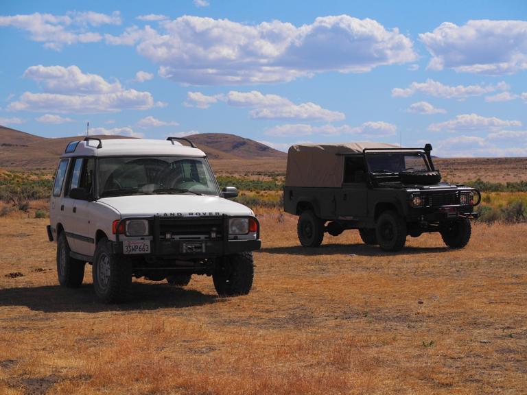
We spend a little time reassessing the packaging of our trucks. Some stuff that we thought was of the prime importance gets demoted and stuffed further into the cargo holds; some - moved up to be within an easier reach. We grumble about the dust - boy, little we know about how much are we going to get today! Chris' biggest annoyance through the entire trip is the big Pelican 1650 with his kitchen equipment has to be put right up against the bulkhead - so it order to get to the cookware, everything must come out.
I fuss more with the fridge. Somehow, the cheap bastard worked just fine on the way up U.S.395, but refused to work for any extended period of time later. I wonder why; in the meantime, rack of lamb is transferred to Chris' ARB, and I rig up a bizarre dual power feed to the fridge (both 12VDC and 120VAC from a little inverter).
Under the hood everything seems to be normal - fluids are where they are expected, and not - where they are not. I find myself slightly "personalizing" my land yacht - not enough to name her yet.
Our task for the day: descend to Highway 140, and cross about half the state of Nevada to get to a tiny town of Jarbidge in the mountains in the East.
Soon, we're bouncing on the rough two-track, and nearly catching up with jeep brigade. The views along the trail are outstanding.
Since we're at nearly 8000 ft, it is not too hot yet, and there is little dust - a perfect morning ride.
An hour and a half later, we're down on pavement; 140 takes us South-East towards U.S.95.
I will cross or drive on this road several more times during this trip; now, we're only going South on it until the middle-of-nowhere gas station.
Remarkably, there is an old J-truck with a snowplow attached in front; it can also be found on Google Earth, so it may be a semi-permanent fixture.
At the pump, Chris is ambushed by a crusy local; besides expressing the general admiration to the 110, he offers a wealth of knowledge of geography of Northern Nevada.
By the time Chris finds a way to bid goodbye, he is assured that there's no way in hell we could be in Jarbidge today.
We hit a graded dirt road known as Nevada 290, where I promptly get hit with a rock from an on-coming truck right into the edge of the windshield.
It takes no time for the crack to grow to 6 inches, and it slows down some afterwards. A few miles later, we leave the graded road for the dirt.
The names of the roads we are on will remain unknown to me until the day I'm writing this down - Shelton Lane, Chimney Reservoir Road, back to Shelton Road...
Close to the mid-point in Nevada (around longitude 117 deg West even), we cross the creek and start a gradual but relentless climb.
The road (again, according to Google Earth) becomes something bizarre like SSSR 18, then loses one of the Ss.
The scenery around - high desert, with not very dense sagebrush stretching for light years around. "Keep going, nothing to see here."
We do stop to pay a short visit to remnants of a farmhouse ( 41.480853°N, 116.549142°W, 5735 ft above WGS-84) - out of sheer desire to rest our eyes on something prominent.
I vaguely remember Chris showing me a faint dark outline on the horizon and telling me that these are Jarbidge Mountains - my thought at this time was "shit... it's already close to 4, and the mountains are still on the horizon..."
I am doing my best to keep from asking Chris a perennial classic - "Are we there yet?" The reality that we still have at least four hours to plow on settles in...
Later, we hit Nevada 226 South - paved!!! yesss!!! - by which time mountains advance somewhat to closer inspection.
The quiet solitude of driving on smooth asphalt only lasts for 12 short miles - after which we leave it yet again on National Forest road 473, winding up along the canyon carved by Jack Creek.
From the moment I had a rock into my windshield and to this point, we have not seen another vehicle. Not one.
The hamlet near Jack Creek looked somewhat bizarre - not abandoned, but not prospering, either. It also had its own collection of neglected classic vehicles.
The road wastes no time to get to climbing business - steady 200 ft per mile for many miles to come. It crests at a shallow pass near some formerly large mining operation, then descends a bit, and spends nearly forever across a high desert plain at about 6500 ft. And then - boom! - we're on pavement again, on Nevada 225. For about half a mile... then off to the East again, on a dirt road with a name like Eco Road 746.
About 20 miles later, we are off to the North along Jarbidge-Charleston County Road, a.k.a. N.F.062. Google Earth shows no traces of human activity in a location it designates as Charleston...
We are still losing elevation. The road starts a very gentle climb several miles later, and scenery changes little by little.
Occasional junipers show up, then thicken, then become interspersed with furs, rare aspens turn into aspen groves, merge with furs... Junipers are gone. Then aspens are gone.
By the time I stop to take a photo of an "O"-shaped lake, we're at 8200 ft and still climbing. The road crests at about 8500 ft, and we begin a quick descent into Jarbidge.
At the town square, between a saloon, fire station, town hall, and a gift show we see Jason Rose's 110 Station Wagon and Kevin Day's LR3.
The guys are, of course, at the saloon - have been waiting for us for a couple of hours.
We celebrate our reunion ... but it's a
different story.


